

According to meteorologists, the primary reason behind the sudden slowdown is a "break monsoon" condition combined with a significant shift in the monsoon trough. In meteorology, a trough is an elongated region of low atmospheric pressure represented on weather maps as a dashed line. Such systems typically generate dense cloud cover, transport moisture, and produce rainfall by forcing warm, moisture-laden air to rise. The India Meteorological Department primarily monitors the monsoon trough and the offshore trough, both of which play a critical role in determining rainfall patterns across the country.
Experts explained that the monsoon trough, a low-pressure belt stretching across India that serves as the main pathway for rain-bearing winds, has now shifted away from the plains of northwest India. As a result, rainfall activity has significantly reduced over Delhi-NCR and western parts of Uttar Pradesh.
M Danish, Scientist at the India Meteorological Department in Lucknow, said the monsoon belt has shifted toward the Terai region in the northern part of Uttar Pradesh. He explained that only the northern parts of the state are currently receiving rainfall because of this movement.
Explaining the slowdown, Danish said the change is directly linked to the shifting monsoon trough. He stated that a low-pressure system developed last week, causing the trough to move toward northern areas, which in turn shifted the entire monsoon belt northward.
The northward migration of the monsoon trough toward the Himalayan foothills has concentrated rainfall over northern districts of Uttar Pradesh, including Gorakhpur, Balrampur, and Kushinagar, as well as eastern and northeastern India, while leaving Delhi-NCR and western Uttar Pradesh largely dry.
Meteorologists also attribute the current weather to a classic break monsoon condition. Mahesh Palawat, Vice-President of Meteorology and Climate Change at Skymet Weather, said northwest India, including Delhi, has remained completely dry over the past several days because a break monsoon condition has become established across the region.
Palawat explained that a break monsoon develops when the axis of the monsoon trough shifts toward the Himalayan foothills. As a result, winds blowing south of the trough originate from the west instead of carrying moisture from the Bay of Bengal. These dry winds sharply reduce humidity, suppress cloud formation, halt rainfall, and cause temperatures to increase across affected regions.
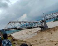
While northwest India continues to experience dry conditions, eastern and northeastern India are witnessing heavy rainfall. According to Palawat, multiple cyclonic circulations over northeast Bihar, Bangladesh, and northeastern Assam are drawing abundant moisture from the Bay of Bengal into those regions, resulting in persistent rainfall there.
Although break monsoon conditions are a normal seasonal feature, experts noted that the current dry spell has lasted much longer than usual. Such breaks generally occur once or twice during July and August and typically continue for four to six days.
Palawat said the present break has already extended to approximately 11 to 12 days, making it unusually prolonged. He attributed the extended dry spell to the growing influence of El Nino, stating that its impact has become clearly visible during the second half of July.
The prolonged break has also affected the country's cumulative rainfall figures. Palawat noted that by July 9, widespread rainfall had reduced the national monsoon rainfall deficit to 12 percent. However, within just three days, the deficit increased again to 18 percent because of the extended interruption in rainfall. He said it remains to be seen how the monsoon evolves in the coming days, but the influence of El Nino is now clearly evident.
Despite the current dry conditions, meteorologists say the interruption is temporary. Both the India Meteorological Department and private weather forecasters expect the monsoon trough to gradually shift southward, leading to a revival of rainfall across the affected regions.
According to the India Meteorological Department, heavy rainfall is likely to continue over parts of northwest, eastern, and northeastern India during the next three to four days. However, Delhi is expected to remain under partly cloudy skies on Tuesday, with no significant rainfall forecast.
Danish said the trough positioned over the northern part of the monsoon belt has already started moving southward, indicating that the revival of the monsoon has begun.
Palawat provided a more specific timeline for the return of widespread rainfall. He said that once the monsoon trough shifts southward after July 20, rainfall activity is expected to increase again across Punjab, Haryana, Delhi, and western Uttar Pradesh. The renewed rainfall is also expected to bring temperatures down after nearly a week of warm, humid, and predominantly dry weather.
For residents of Delhi-NCR and western Uttar Pradesh, the coming days are expected to remain hot, humid, and largely rain-free. However, weather experts believe relief is approaching as the monsoon trough gradually resumes its southward movement during the final days of July, restoring rainfall across the region and marking the end of the prolonged break monsoon phase.
About The Author










Comment List